3d building 003 3D Model (max)

3D Models » 3d building 003

3D Model by kanhtart

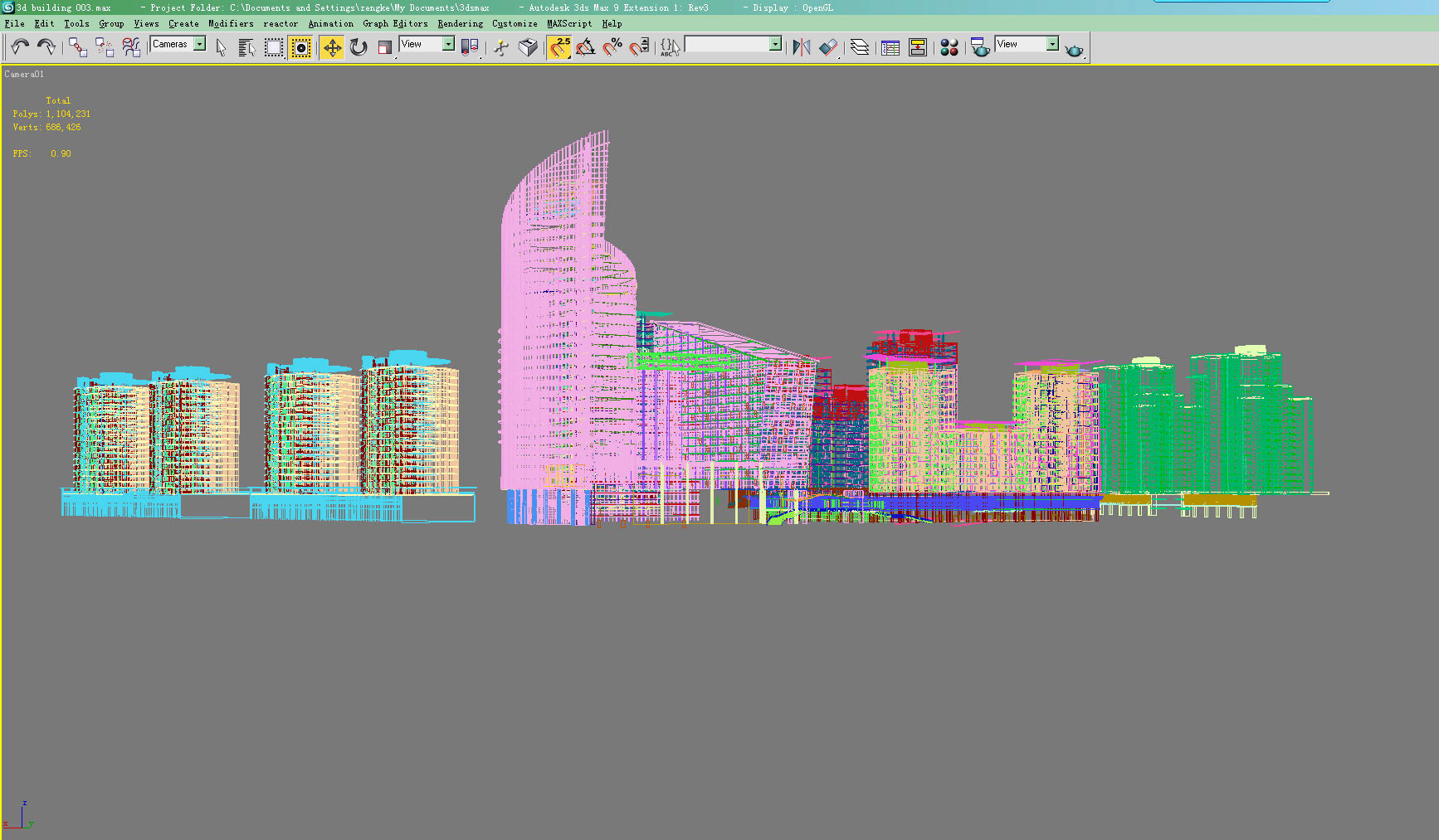
High detailed 3d building.

Previews were rendered with default scanline .
Max file included default scanline version
The file has all lightning setup and texturing ;multi layer phososhop PSD file included.

Any city plan contains an analytical unit and a project proposal unit. Each of them, in turn, includes graphic materials presented in the form of maps (diagrams) and a text part. Among the mandatory schemes in the composition of the general plan are usually provided:

  • the scheme of objects of electricity, heat, gas and water supply of the population within the city;
  • the scheme of public roads, bridges and other transport engineering structures within the boundaries of settlements;
    a scheme for the use of the territory of a municipality with the display of the boundaries of lands of various categories, other information on the use of the territory concerned
  • the boundaries of the territories of cultural heritage sites;
  • the boundaries of zones with special conditions of use of territories;
  • the boundaries of territories at risk of occurrence of emergency situations of natural and man-made character;
  • the scheme of the boundaries of areas of the negative impact of local capital construction objects in the case of the placement of such objects
    diagram of the planned boundaries of functional zones with the display of the parameters of the planned development of such zones;
  • diagrams showing the zones of the planned location of local capital construction objects;
  • maps (schemes) of the planned borders of the territories, the documentation on the planning of which is to be developed as a matter of priority;
    scheme of existing and planned land boundaries of the industry, energy, transport, communications.

City plans in different countries vary in name, composition, functions and legal status. Reconstruction, development, and development of the territories of a number of large cities are carried out without any single document of planning and zoning of the territory. In many Western countries, the general plan as a legal document is a recommendation, that is, it is not a source of urban planning rights. At the city level, settlements in the role of such are the rules of land use and development, including a map of town planning zoning, town planning regulations.

3D building city plan 3D model on Flatpyramid.


Available Sample File for Download

USD $150.00
card Safety
Delivery Format: Download Only!

Available Source 3D Model File Formats

Specifications

  • GeometryPolygonal
  • AnimatedNo
  • MaterialsYes
  • RiggedNo
  • TexturesYes
  • File-formats3D Studio Max file (.max)
  • NID26937
  • LicenseRoyalty Free
  • Copyright TransferredNo
  • ResellableNo
3D Model ID: 194073

Published on: December 5, 2011